When the Land Moves
What I saw in Christchurch and Kaikōura changed how I teach earthquakes. Here's what happened — and how I am now offering it for your classroom.

Reflections from Christchurch, Kaikōura, and a career in earthquake education
In 2011, in one of several visits, I was on the ground in Christchurch soon after the February aftershock struck. What I saw there still shapes the way I think about teaching geology and earthquakes today.
Of many shocking sights, one moment really had me baffled:
I turned a corner in the central city and stepped from normality into devastation.
One street looked almost untouched — shops standing, windows intact, brick walls only slightly cracked. I turned the corner, and it looked like a war zone. Buildings shattered. Roads split. Dust and rubble all around.
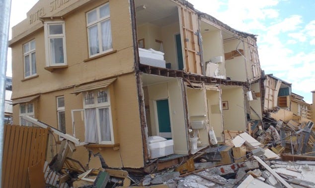
What struck me most was how localised the destruction was. Earthquakes don’t always flatten everything at once — they work in strange and selective ways. This was something that geoscientist colleagues were to teach me - how seismic energy gets amplified or muted by the shape of the landscape, the direction of the energy, what rock types the ground is made of, and even the design of buildings.
Flying rocks and human resilience
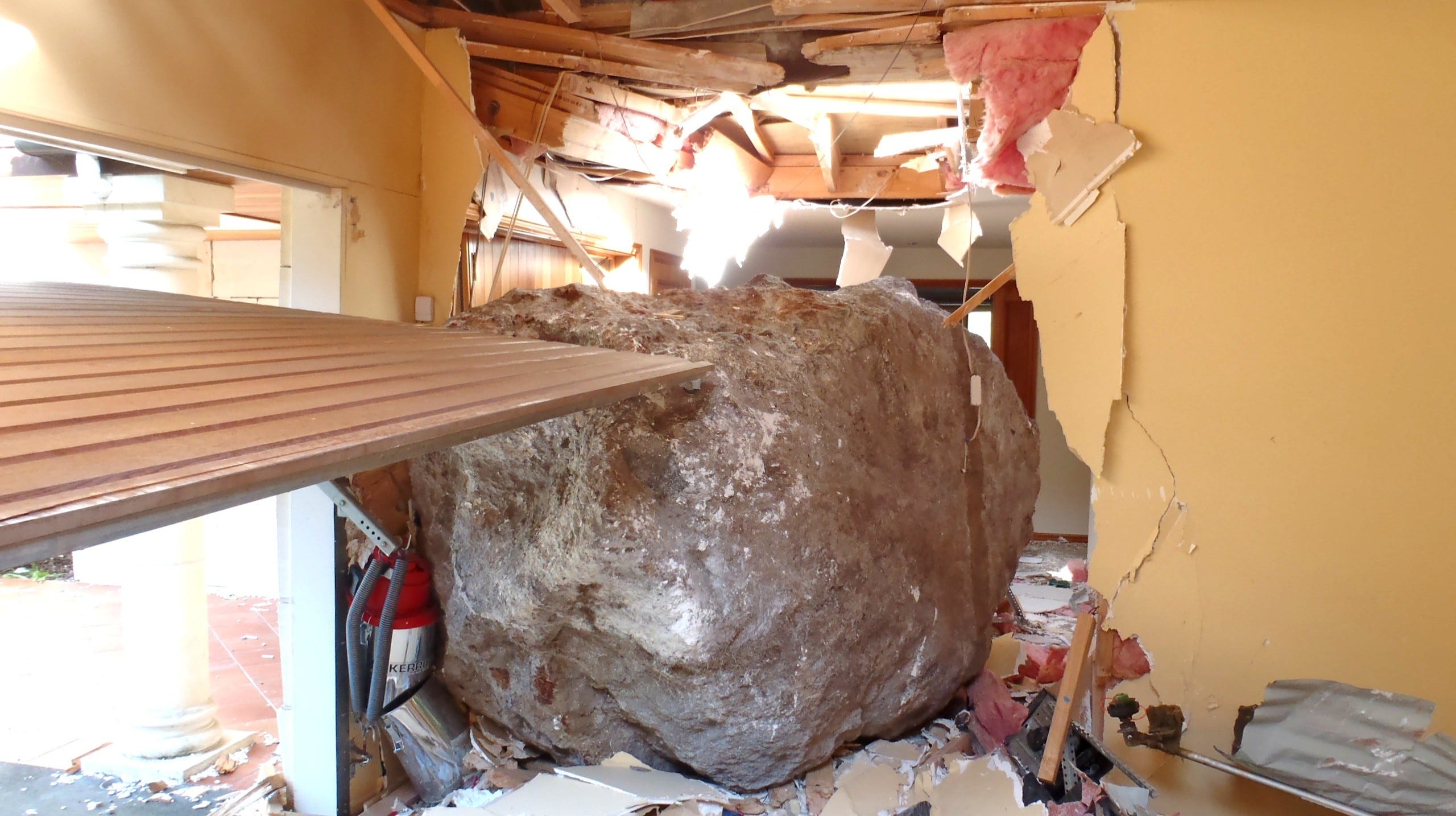
One of the more horrifying realities was the boulders — rocks that had torn loose from the Port Hills, hurtled down the slopes in 60 metre bounces and smashed their way into homes. In some cases, they went right through from one side to the other like cannon balls.
The emotional impact was just as intense.
Aftershocks would hit and you could feel the adrenaline in people. It was like their nervous systems were stuck on alert — and understandably so. Everyone knew another shake could come at any time. Good friends of mine decided to move away as the stress of the aftershocks became intolerable.
But amidst the destruction, there was also connection.
The Student Volunteer Army mobilised thousands of students to shovel liquefaction, deliver food, and help wherever they were needed. The Cardboard Cathedral rose from the ruins as a temporary place of worship and gathering — a powerful symbol of hope, inspired creativity, and resilience that is still a wonderful place to visit. There were many examples of how the community came together.
Kaikōura: When the land rips
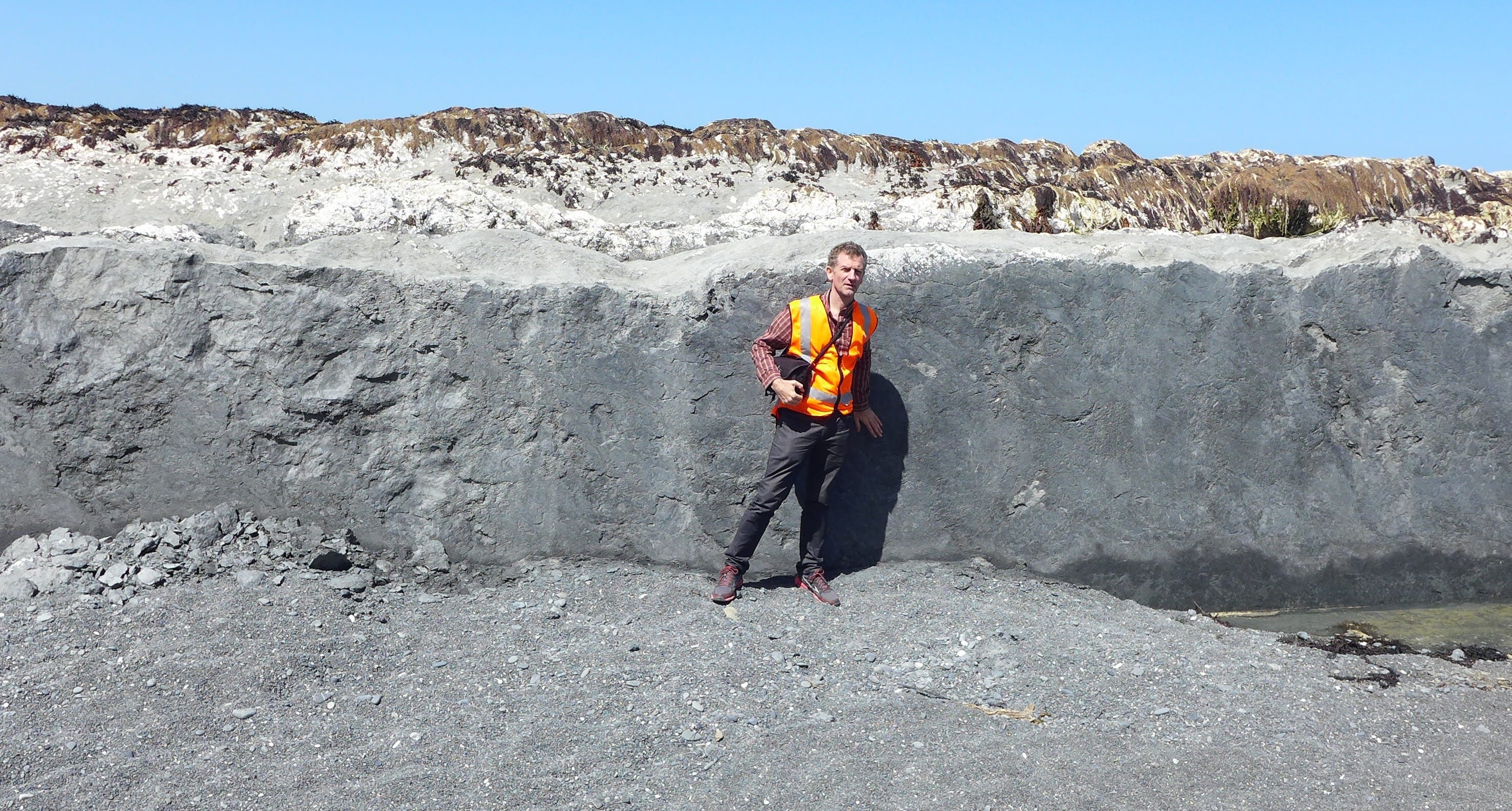
Seven years later, I found myself in Kaikōura after the massive 2016 earthquake. I was again with the GeoNet response team, documenting the landscape changes with a video camera.
This time I really took in that it wasn’t just buildings or roads. The whole landscape itself had moved.
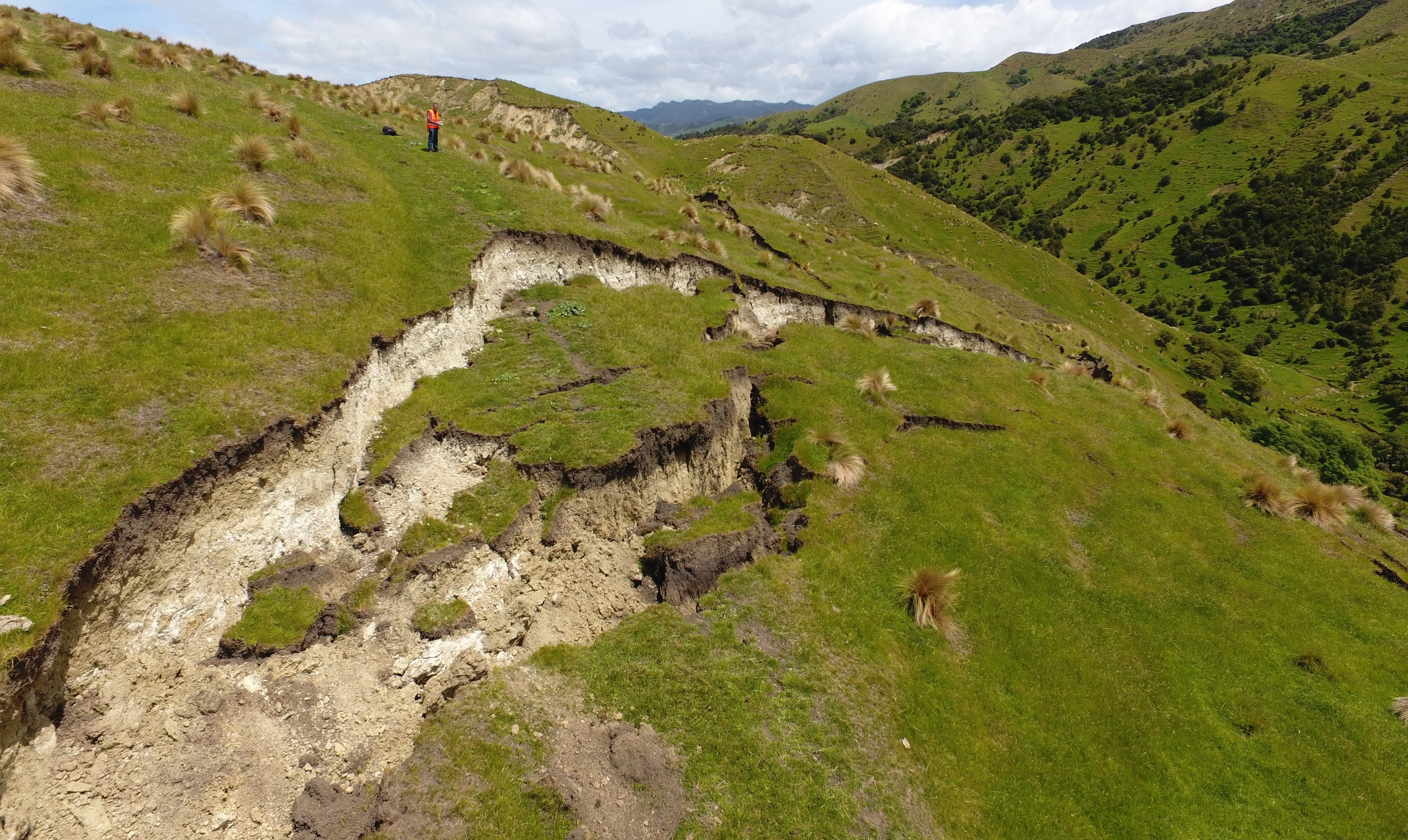
Faults tore open visibly across farmland
Mountainsides collapsed
The Clarence river shifted its course where one side of it was uplifted by several metres
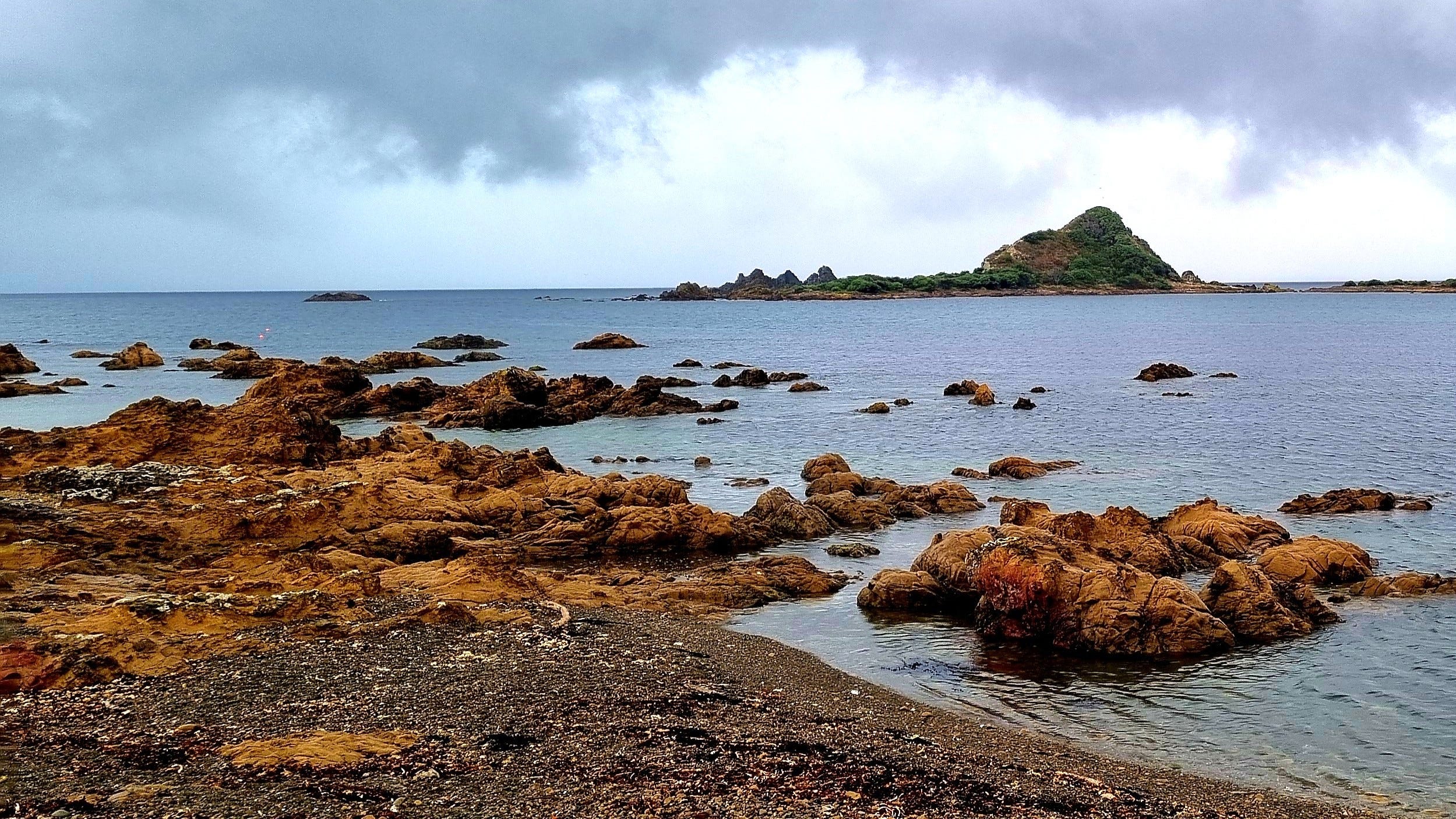
The seabed rose and became dry land
Railway lines were lifted and twisted like toys
It was like seeing the country being reshaped in real time. And yet when I looked across from the coast to the ranges, it became clear that this is just another day in the evolution of a landscape that has experienced - and been shaped by - countless such events.
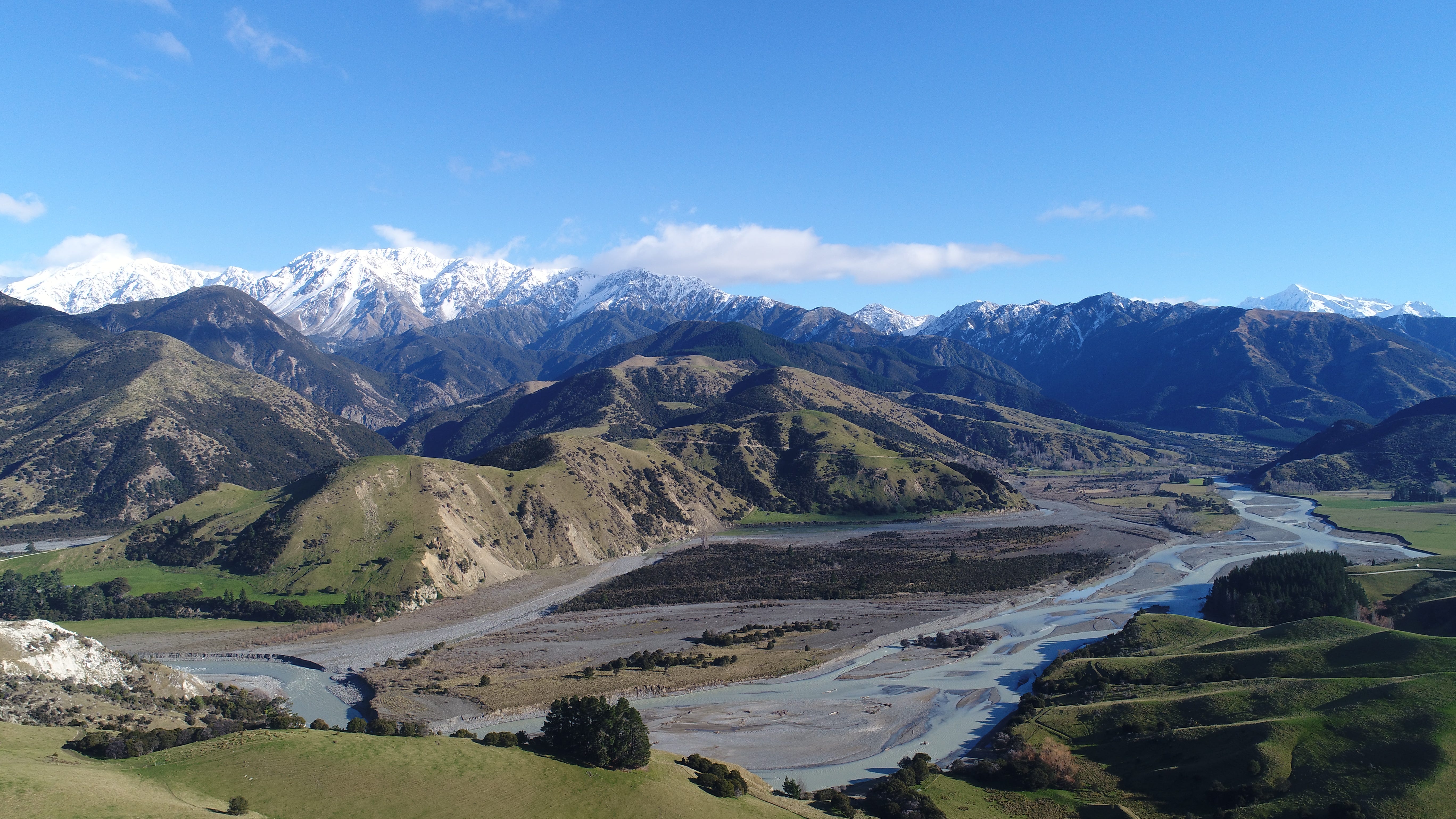
I remember returning to Wellington and looking out at the south coast — the jagged rocks, the uplifted terraces from 1855 — and feeling like I was seeing it all with new eyes. These weren’t abstract features. They carried a memory of exactly the same kind of upheaval. A ‘New Zealand normal’ drama of landscapes in creation.
From real-world science to the classroom
These experiences were just some of how I spent my time working as a science communicator with GNS Science — (New Zealand’s earth science research institute - now Earth Sciences New Zealand). My work alongside scientists included dozens of expeditions right across New Zealand and occasionally overseas. But those earthquakes taught us all that although we can have many years of relative calm, huge devastating events can hit with no warning and change lives in an instant.
Our two biggest faults - the Hikurangi megathrust and the Alpine Fault will show us their teeth one day, as could any others of our many active regional faults.
Now, as I run my own science communication and geo-education business, I continue sharing NZ geoscience with teachers and students in schools.
Inevitably earthquakes are part of the content that I cover. After over 30 years of teaching the topic, I always try to make it clear, fascinating, and memorable.
Thanks for reading this far. If you are a teacher and interested in how to make the topic of earthquakes stick in the minds of your students, I created a brand new course with everything that I have distilled down from my experiences - just for you!
✨ Teach Earthquakes with Confidence
A practical online course for middle to high school teachers
This self-paced online course gives you everything you need to:
✅ Explain complex earthquake concepts in clear, student-friendly ways
✅ Connect earthquakes to plate tectonics, erosion, and real-world examples
✅ Run engaging, hands-on activities with simple materials
✅ Teach earthquake preparedness with relevance and realism
✅ Access classroom-ready resources, images, slides, and support
✅Uses NZ examples but the teaching principles and activities apply worldwide
Whether you want to improve your own confidence or just save time planning lessons, this course is for you.
It launches Friday 25 July — and there’s a 50% discount available until that date. CLICK BELOW FOR MORE INFO
Earthquakes aren’t just topics in a textbook. In many parts of the world they shape the places we live and generate life changing impacts that we could face at any moment in the future.
Let’s help students engage with the topic by awakening excitement, curiosity and understanding. Want to know more? Click that button above.
Thanks for reading,
Julian
Science communicator & educator | Out There Learning